Department of Structural and Geotechnical Engineering
Department of Structural and Geotechnical Engineering
Department of Structural and Geotechnical Engineering
Department of Structural and Geotechnical Engineering
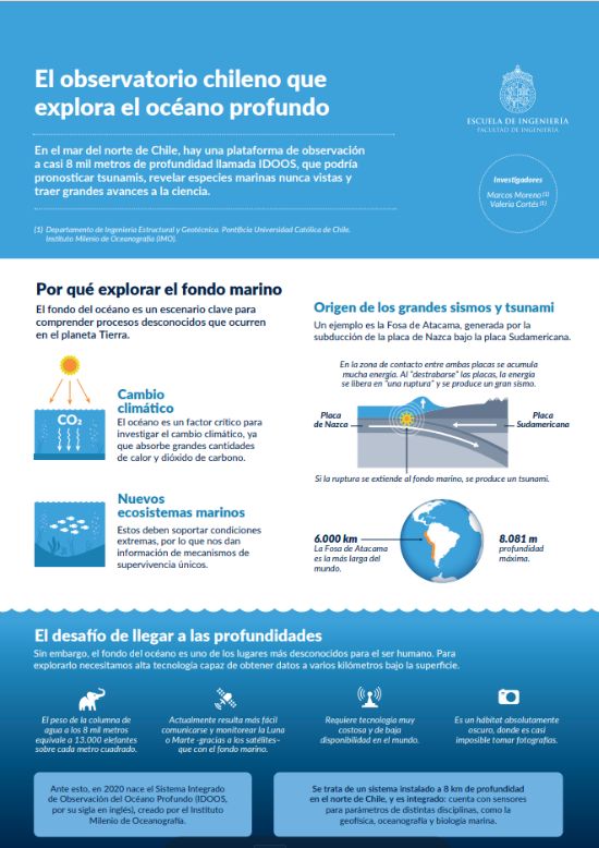
The deep ocean is one of the least explored environments on the planet. Exploring it poses enormous challenges: it is a completely dark habitat, the pressure of the water at a depth of 8,000 meters is equivalent to the weight of 13,000 elephants. Under these extreme conditions, communication and image capture require highly advanced, and often costly, technology.
Faced with these challenges, an obvious question arises: why go to such lengths to study the seafloor? There are many reasons. The ocean plays a key role in regulating the global climate by absorbing heat and carbon dioxide (CO₂) from the atmosphere. Monitoring these variables on the seafloor could provide highly valuable data for studying climate change.
The deep ocean may also hold important biological clues. Identifying still-unknown species capable of surviving under such extreme conditions could shed light on unique mechanisms of adaptation and survival.
Beyond climate and biodiversity, the seafloor is also key to understanding major natural hazards. Major earthquakes and tsunamis originate there, making it a strategic location for collecting data that can help scientists better understand these events and develop early-warning systems. Off the coast of northern Chile lies a particularly important setting for this type of research: the Atacama Trench. It is the longest oceanic trench in the world, extending for nearly 6,000 km and reaching a depth of 8.81 km. Here, the Nazca Plate, moving in from the ocean, converges with the South American Plate from the continent.
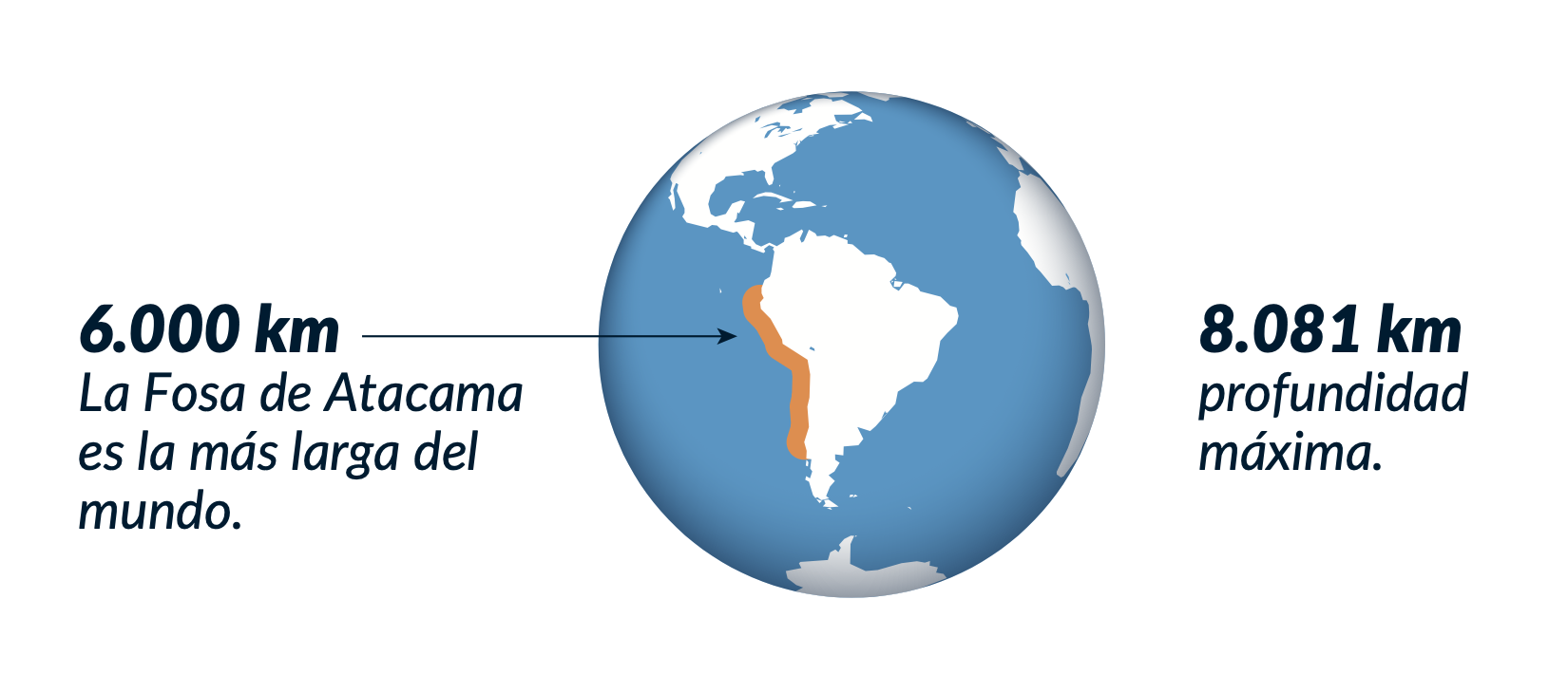
Located along an active tectonic boundary, the Atacama Trench offers a unique setting for studying earthquakes and tsunamis.
At the boundary between the two plates, friction prevents them from moving freely, causing stress and energy to accumulate over time. Eventually, the plates slip and release that stored energy in the form of a major earthquake. If the rupture reaches the seafloor, it can displace large volumes of water and trigger a tsunami.
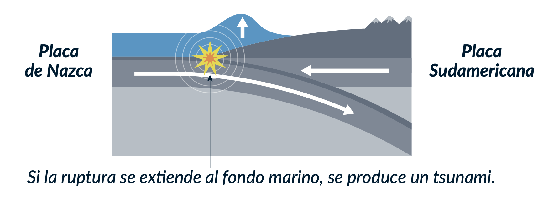
At the Atacama Trench, energy accumulates along the boundary between the Nazca and South American plates. When released, it can generate earthquakes and tsunamis.
A Chilean milestone in global underwater exploration
Deep in the Atacama Trench, a team of Chilean researchers have deployed a true “underwater laboratory,” unlike any other, marking a major step forward in deep-sea exploration. Known as the Integrated Deep-Ocean Observing System (IDOOS), the project is carried out by the Millennium Institute of Oceanography and is led by UC researchers Marcos Moreno and Valeria Cortés.
What makes IDOOS unique is the range of phenomena it can measured at the same time. Its instruments collect data across several scientific disciplines, offering a more complete view of what is happening in the deep ocean. In 2023, researchers installed two instrumented moorings 100 km off the coast of Taltal, at depths of 7,800 and 4,500 meters in the Atacama Trench. They record ocean currents, temperature, salinity, water density, CO₂, and oxygen. Five additional pressure sensors track movements of the seafloor, helping researchers estimate the energy accumulating along the tectonic boundary that could be released in a future earthquake.
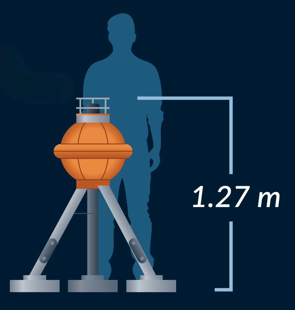
Five pressure sensors were installed at different depths along the seafloor to track movement and quantify the energy accumulating in the area.
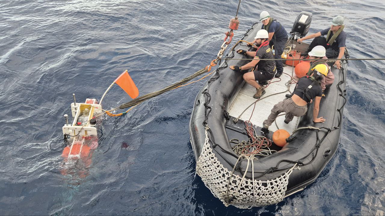
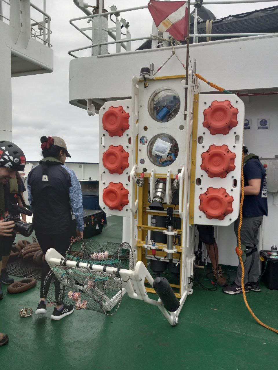
To install and maintain the equipment, the research team travels by ship to the Atacama Trench. During each expedition, they deploy a “lander” from the vessel: a device fitted with a camera and bait designed to attract marine life. After several hours on the seafloor, the lander is brought back to the surface for analysis. The team also maps the seabed using sound. An instrument sends acoustic waves down to the seafloor, where they bounce back to the ship. By analyzing the returning signals, researchers can reconstruct the topography of terrain that has never been directly seen by humans. This technique, known as high-resolution bathymetry, works in a way similar to medical ultrasound and allows scientists to create detailed maps of the ocean floor.
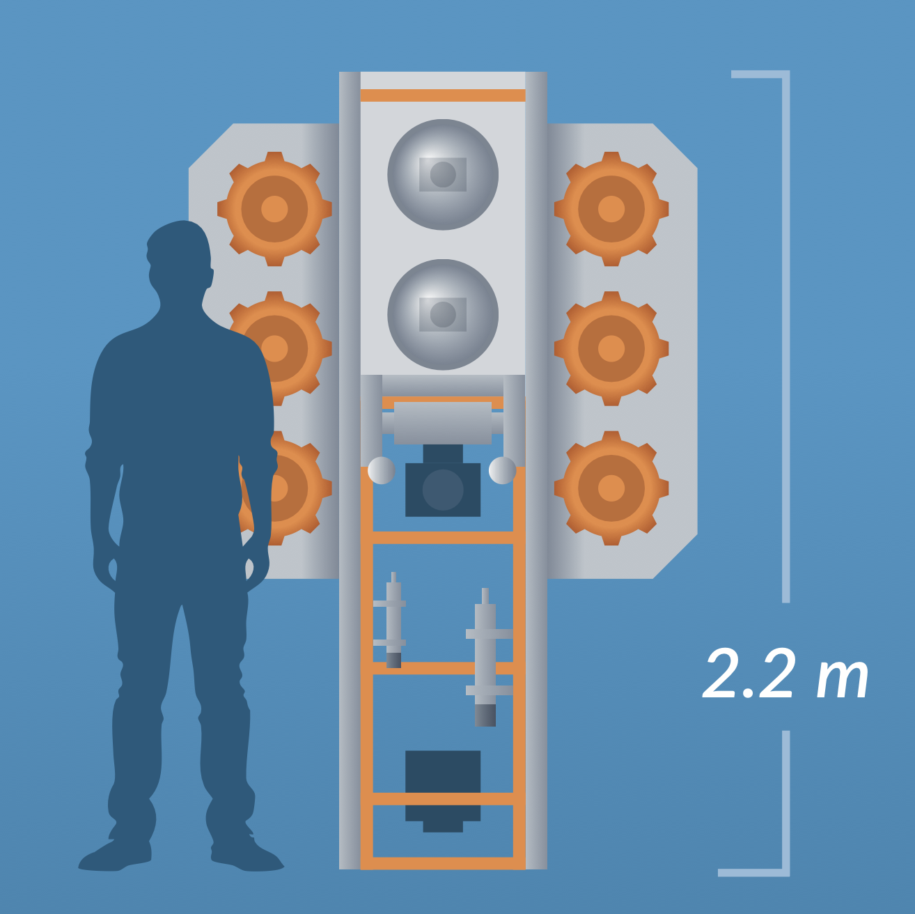
During each expedition to the study area, the scientists deploy this “lander” into the ocean and retrieve it several hours later. It is equipped with cameras and bait to attract marine species.
Department of Structural and Geotechnical Engineering
Department of Structural and Geotechnical Engineering
IDOOS will continue operating and providing valuable information in the years ahead, and its impact is expected to extend even further. A new project is already underway, bringing together Chilean and U.S. universities to install 50 multidisciplinary observation platforms in the Valparaíso Region. The initiative aims to study natural phenomena such as earthquakes, tsunamis, volcanic eruptions, and landslides, taking advantage of Chile’s unique geography and the scientific expertise that has made projects like IDOOS possible.
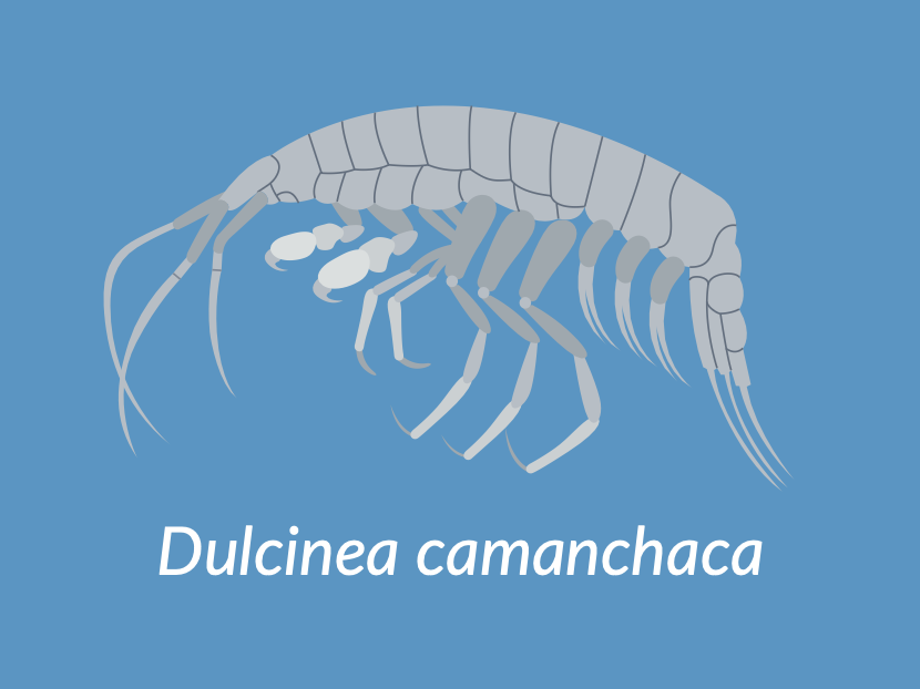
“Dulcinea camanchaca” is a previously unknown species that lives in the deep ocean. It was discovered through the IDOOS project.
The pressure sensors have also detected a significant buildup of energy reaching the seafloor. If that energy is suddenly released, it could trigger a tsunami. Researchers now hope to connect these sensors with existing seismic and oceanographic monitoring systems in Chile to improve early-warning capabilities and potentially detect tsunami risk before an earthquake occurs.
Another major finding so far, among many others still being studied, is the discovery of Dulcinea camanchaca, a previously unknown predatory species. The finding challenges the long-held assumption that life at these depths is dominated only by scavengers feeding on dead organic matter that sinks from shallower waters.
This is the first underwater map of the area. The section outlined in red shows where the IDOOS instruments were deployed.
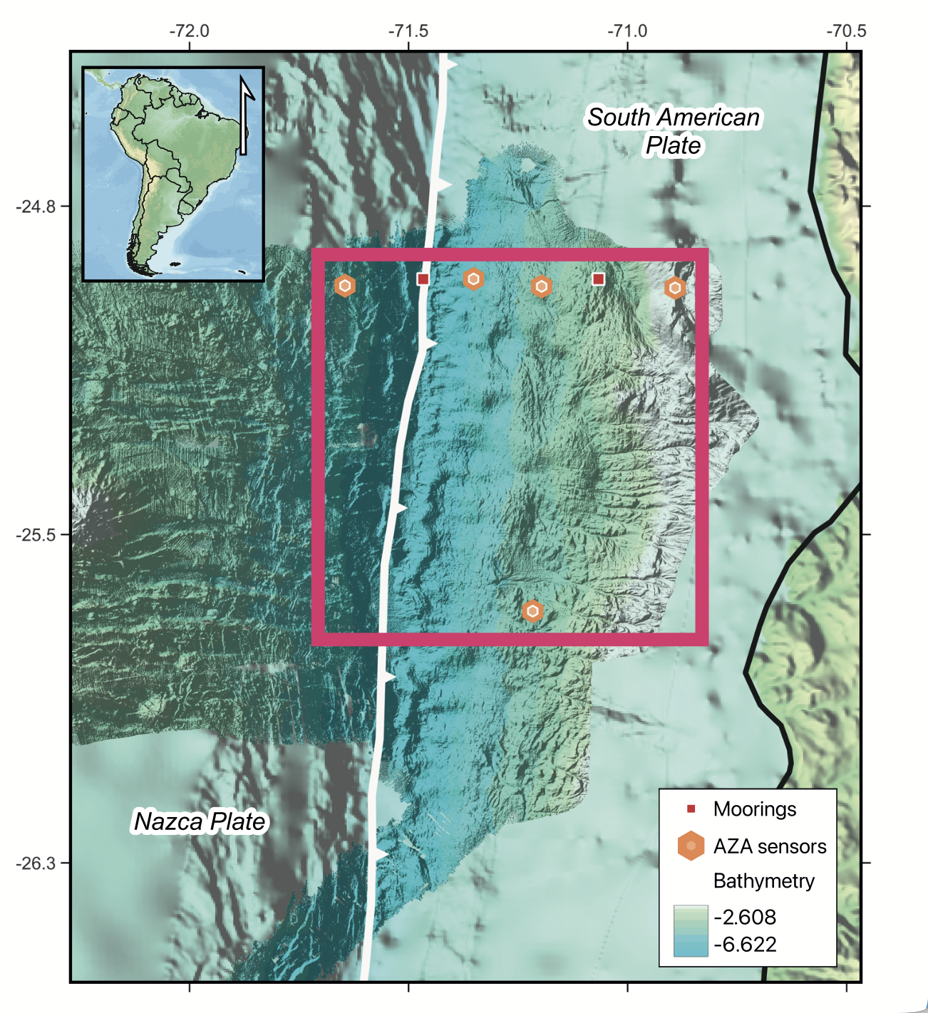
For the first time, researchers were able to map 40,000 km² of this previously unexplored section of the ocean floor using high-resolution bathymetry. Among the features they discovered were massive underwater volcanoes, some more than 3,000 meters high and about 20 kilometers wide.
First Discoveries
Department of Structural and Geotechnical Engineering
Department of Structural and Geotechnical Engineering