Electrical Engineering student
College UC Student – Natural Sciences
College UC Student – Natural Sciences
Student of Natural Resources Engineering
Student of Natural Resources Engineering
Department of Structural and Geotechnical Engineering
Department of Structural and Geotechnical Engineering
Department of Structural and Geotechnical Engineering
Department of Structural and Geotechnical Engineering


Press note: Installing Seismometers at ECIM
Video of the UC Network of Regional Centers and Stations
Lo que se vivió en la salida a terreno de la IPre en ECIM.

Portada » Monitoring Earthquakes Along the Juan Fernández Ridge: Insights from Las Cruces

Electrical Engineering student

Department of Structural and Geotechnical Engineering
Department of Structural and Geotechnical Engineering
Chile is a long and narrow country whose continental coastline stretches for more than 6,400 km, home to diverse ecosystems and remarkable geological structures. Its territory lies within the Pacific Ring of Fire, a region of intense seismic and volcanic activity driven by the constant movement of Earth’s fragments (tectonic plates), making it one of the most seismically active places on the planet.
A Mystery Beneath the Ocean Off Our Coast
Bajo el océano Pacífico frente a la costa chilena, se esconde una estructura tan imponente como poco conocida: el Ridge de Juan Fernández. This submarine mountain chain, approximately 800 km long,, rises thousands of meters from the ocean floor,, dando lugar en sus puntos más altos al Juan Fernández Archipielago Today, the ridge It subducts beneath the South American continent due to the subduction process, just off the coast of the Valparaíso Region.where significant seismic activity of varying magnitudes is recorded..
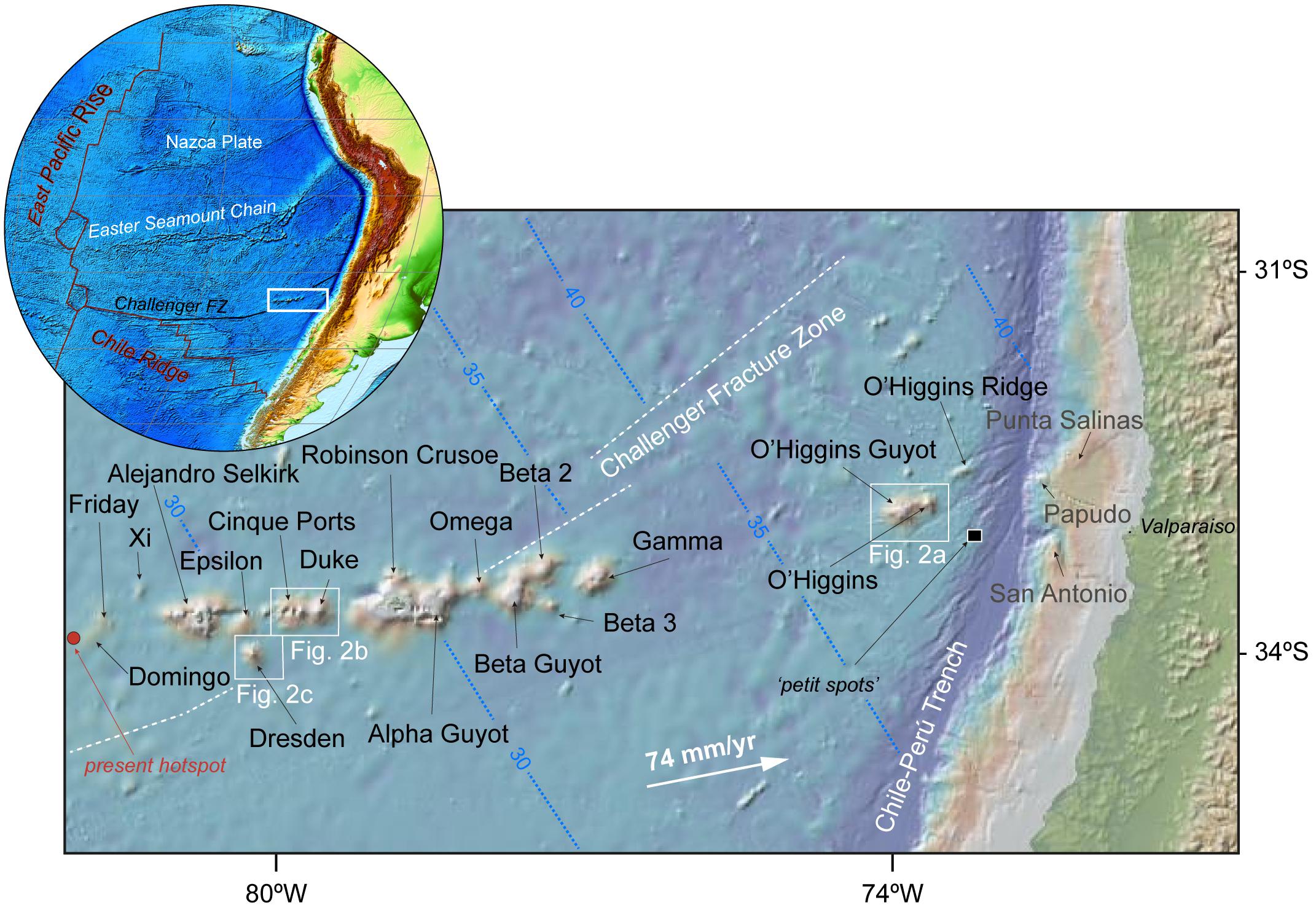
Ridge de Juan Fernández.
Fuente: Lara et. al (2018), 40Ar/39Ar geochronological constraints on the age progression along the Juan Fernández Ridge, SE Pacific. Frontiers in Earth Science, 6, 194. Licencia CC BY 4.0.
There is a hypothesis that the ridge could influence how large earthquake ruptures propagate, and how far they extend off the coast of the Fifth Region, potentially even acting as a natural barrier to earthquakes. To evaluate hypotheses like this, it is necessary to study in detail what happens in its surrounding area.
In this context, the analysis of microseismicity, low-magnitude events ( << 3) that are not detectable by conventional seismic networks, is key for understanding the region’s active geodynamic processes. These small earthquakes allow researchers to examine how the Earth’s crust evolves over time, how energy accumulates, and how it may be released in larger events. Listening to the Earth at these small magnitudes is crucial for identifying active zones and changes in seismic patterns, information that can guide the development of more precise monitoring systems and risk-mitigation strategies.
A Prototype for Microseismicity Detection
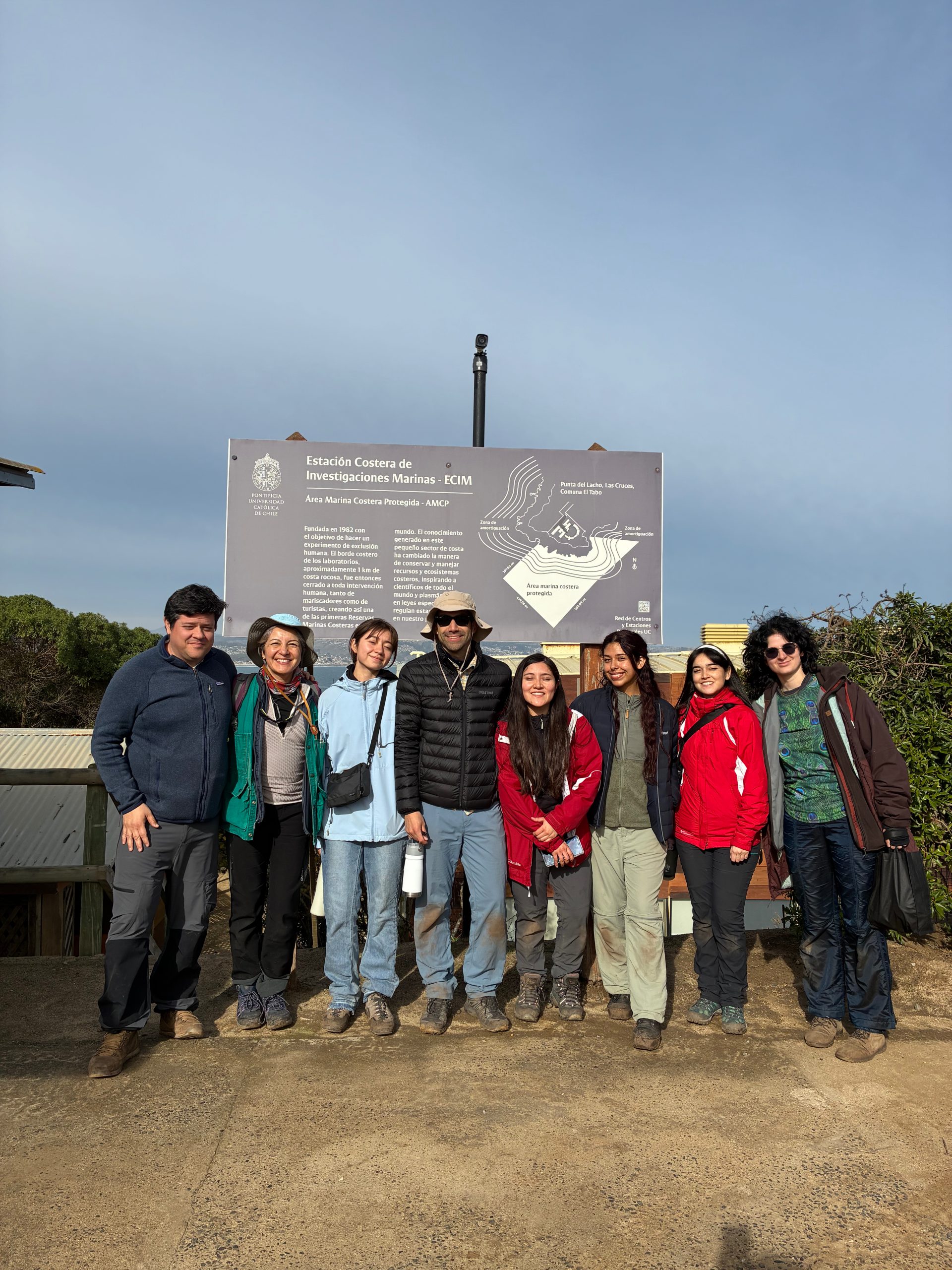
With this purpose in mind, an undergraduate research project (IPre) was launched at the UC School of Engineering, carried out by Valentina Pailamilla, an Electrical Engineering student, under the supervision of professors Leoncio Cabrera and Marcos Moreno from the Department of Structural and Geotechnical Engineering. The IPre project involved designing, developing, and installing a local, autonomous, and sustainable seismic monitoring system aimed at detecting microseismicity along the coast of the Valparaíso Region, specifically at the Coastal Marine Research Station (ECIM). Coastal Marine Research Station (ECIM).
This work is part of a larger SeedFund project funded by the School of Engineering, led by professors Leoncio and Marcos together with collaborating professors Gloria Arancibia and Jorge Crempien from the same department, with the goal of implementing a prototype seismic antenna at ECIM.
Students from various academic units also participated: Camila Ferrus and Constanza Parra (College UC) and Beatriz Bucchi and Micaela Molina (Natural Resources Engineering), who contributed to the installation and commissioning of the monitoring system.
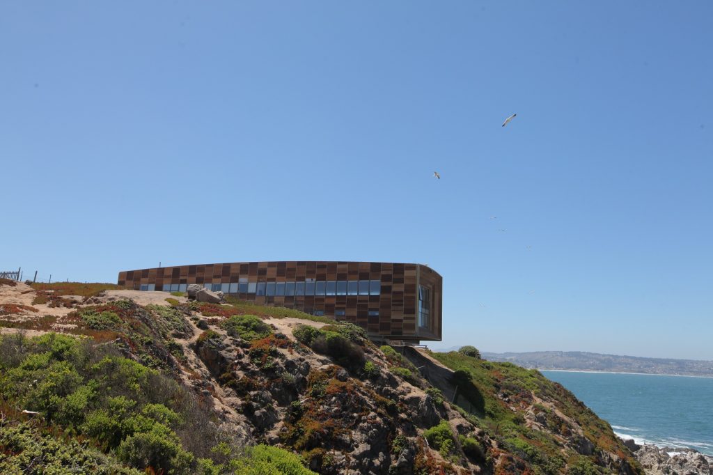
ECIM: the hub of marine and geological research at La Punta del Lacho, Valparaíso Region.
ECIM is a coastal laboratory that is part of the Network of Regional Centers and Stations (RCER) of the Pontificia Universidad Católica de Chile. It combines research, teaching, and outreach in marine sciences, and also includes a Marine Coastal Protected Area. From its location in Las Cruces, the station supports interdisciplinary studies of the marine and coastal ecosystem, and now also focuses on seismic dynamics in the Valparaíso Region.
From Concept to Fieldwork: Building, Testing, and Installing
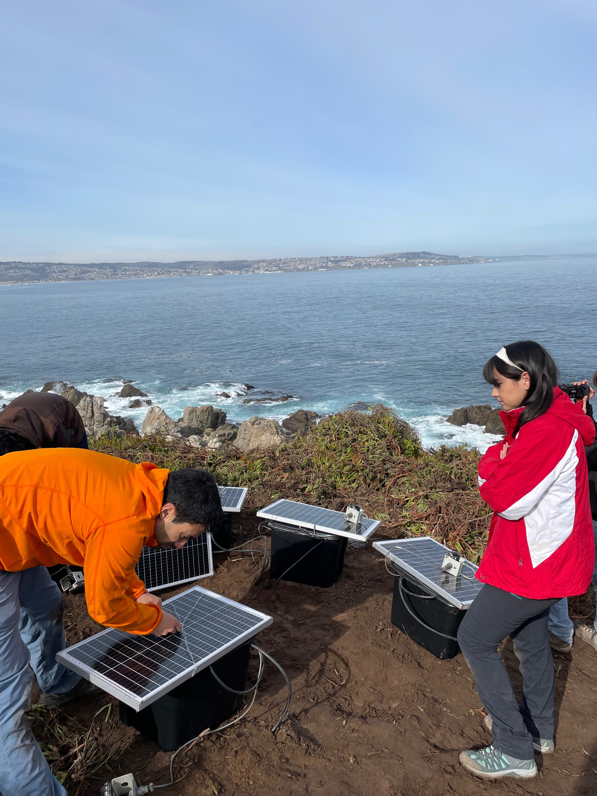
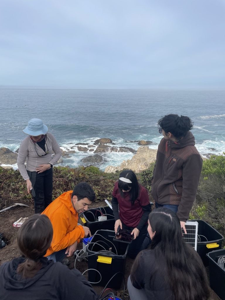
The IPre project unfolded across three main stages. In the first phase, Valentina assembled all the materials required for the field monitoring system: rechargeable batteries, connectors, cables, and an energy-management system. To ensure continuous operation in a coastal environment, the system also included a solar panel with a charge controller, preventing battery depletion and ensuring a stable power supply for the seismometers.
In the second phase, the research team conducted laboratory tests to verify communication between the seismometers and digitizers, GPS synchronization, and the quality of the recorded signals.
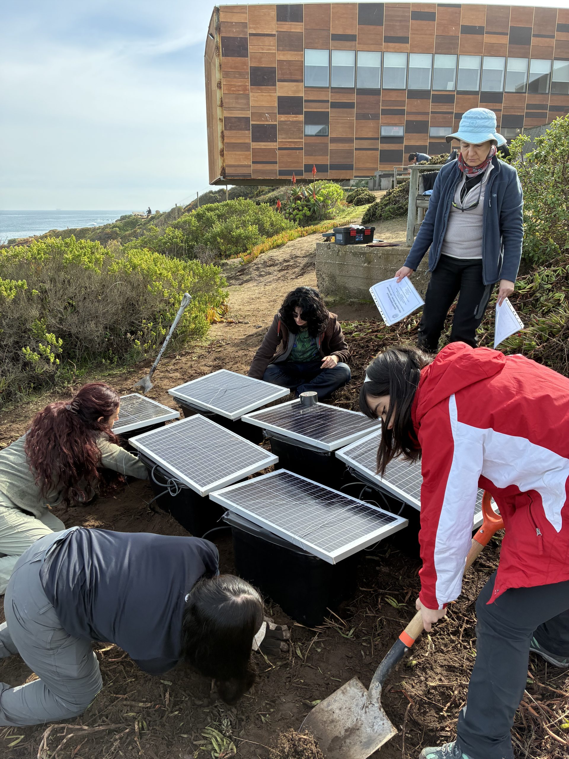
Finalmente, en la tercera y última fase, ya en la ECIM, se seleccionó un sitio idóneo, plano, despejado y alejado del tránsito de personas, donde se instaló un primer sismómetro de prueba que registró datos durante toda una noche. Al día siguiente, tras confirmar la calidad de los registros y validar la prueba de concepto, se incorporaron cinco instrumentos adicionales dispuestos en forma rectangular y separados por un metro entre sí, para conformar un arreglo sísmico experimental. Esta configuración permitió verificar que todos los equipos funcionaran correctamente y detectar cualquier posible problema en el registro de señales, además de facilitar el procesamiento posterior de los datos.
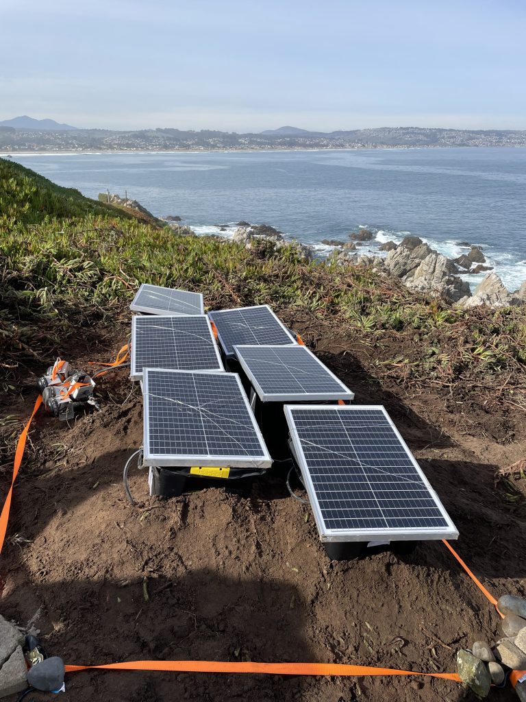
Field Installation of the Seismometer Network
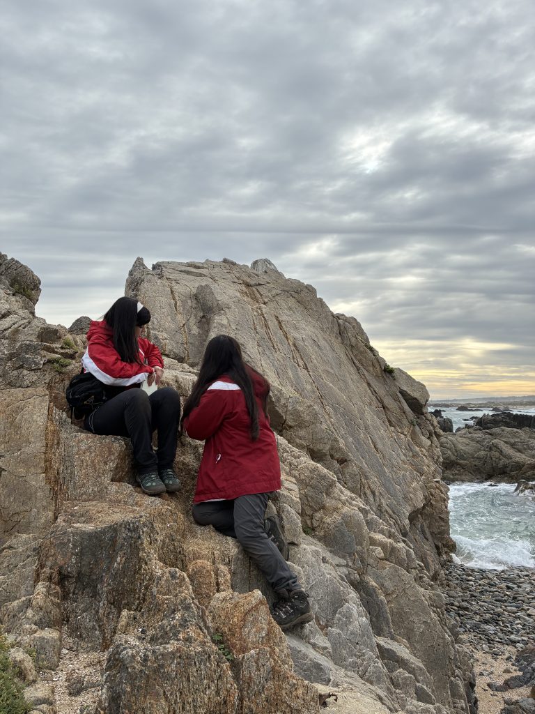
Exploring the Coast: Between Rocks and Tides
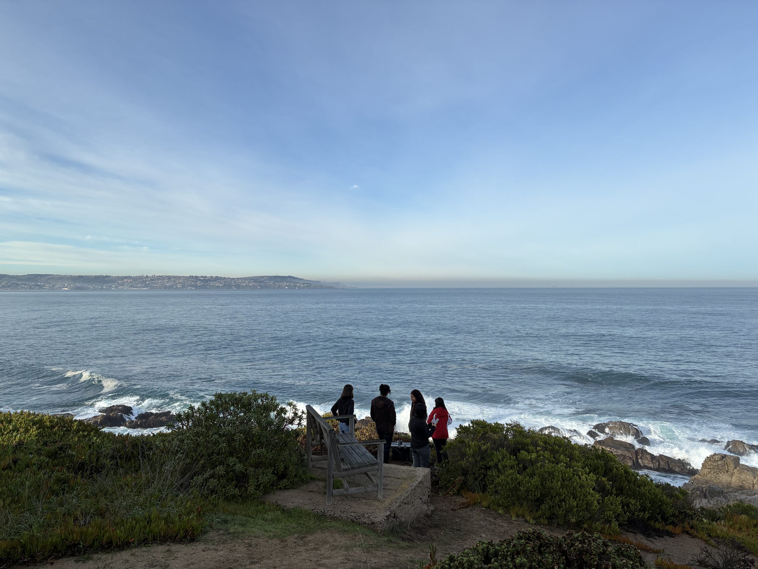
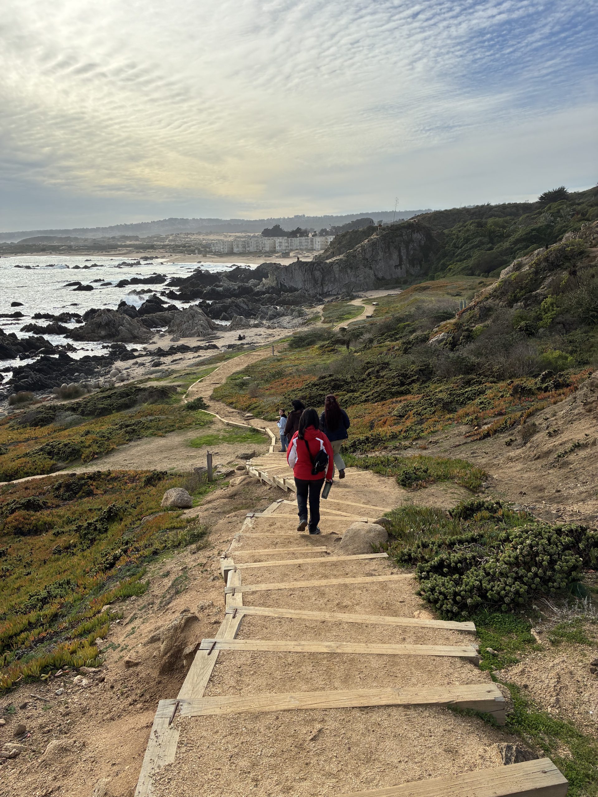
Beyond installation and seismic recording, the team also took the opportunity to explore the coastal environment from a geological perspective. Along the way, they identified various landscape features, such as the arrangement of rock layers and outcrops, rock structures that emerge at the surface due to erosion or tectonic uplift, along with possible evidence of ancient seismic activity. These observations complement the instrumental records by offering a broader understanding of the region’s geodynamics and revealing, in the landscape itself, an Earth in constant transformation.

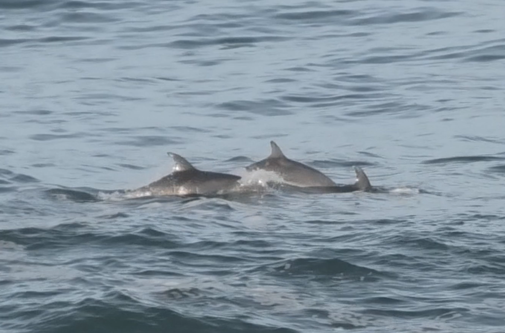
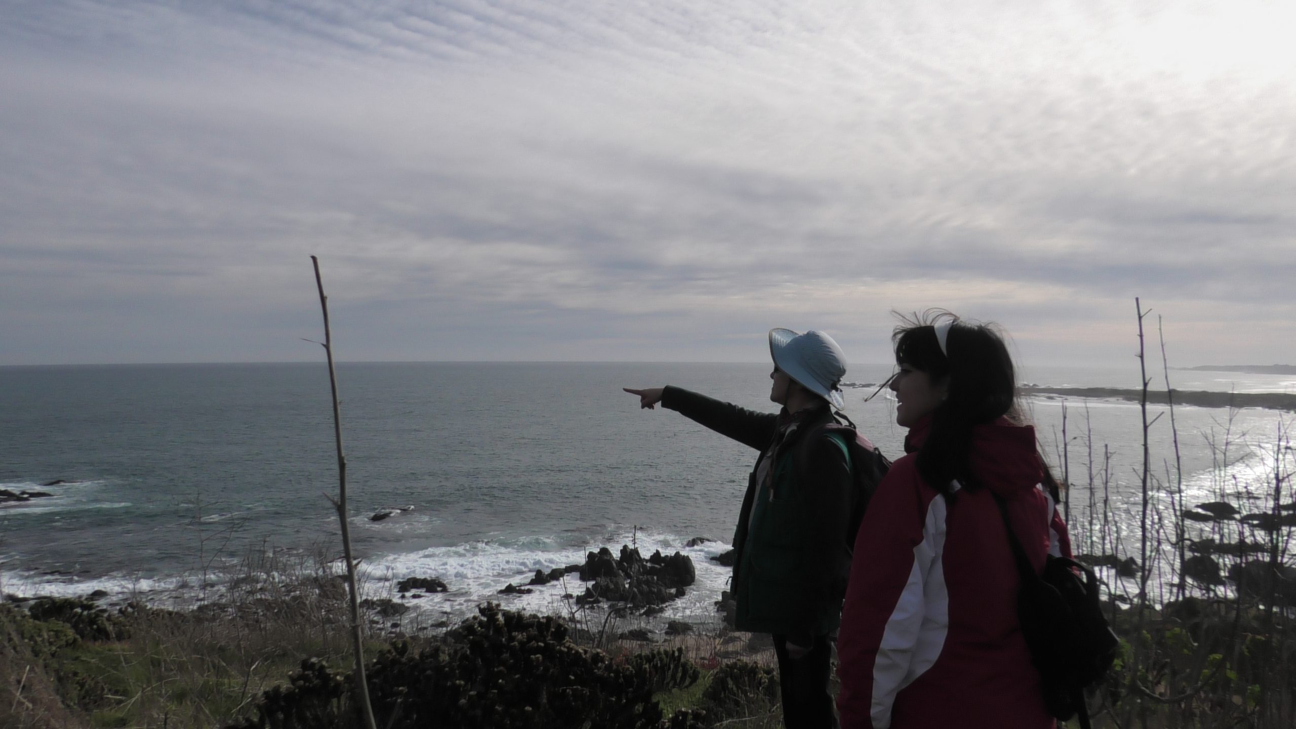
Exploring the surroundings of ECIM at La Punta del Lacho, the team observed the coastal landscape and unexpectedly encountered a group of dolphins swimming (photo by Micaela Molina).
Electrical Engineering student
College UC Student – Natural Sciences
College UC Student – Natural Sciences
Student of Natural Resources Engineering
Student of Natural Resources Engineering
Department of Structural and Geotechnical Engineering
Department of Structural and Geotechnical Engineering
Department of Structural and Geotechnical Engineering
Department of Structural and Geotechnical Engineering
Press note: Installing Seismometers at ECIM
Video of the UC Network of Regional Centers and Stations
What was experienced during the IPre field trip at ECIM.
Se espera que los resultados de monitoreo permitan validar que una red de detección local, más cercana al área de interés, puede identificar una mayor cantidad de eventos sísmicos de menor magnitud (que suelen ser desapercibidos por las redes nacionales convencionales), además del correcto funcionamiento de los sismómetros que se probaron.
This project illustrates how engineering and geosciences (the study of Earth sciences) can come together to create hands-on learning experiences and open new avenues for studying microseismicity. The installation of the monitoring prototype along the coast of Las Cruces, with solar-powered seismometers operating under real conditions, laid the foundation for future research that could improve the detection of small earthquakes and deepen our understanding of the region’s seismic dynamics.
Small Movements, Big Revelations
Electrical Engineering student
Professor at the Department of Structural and Geotechnical Engineering